best laid plans

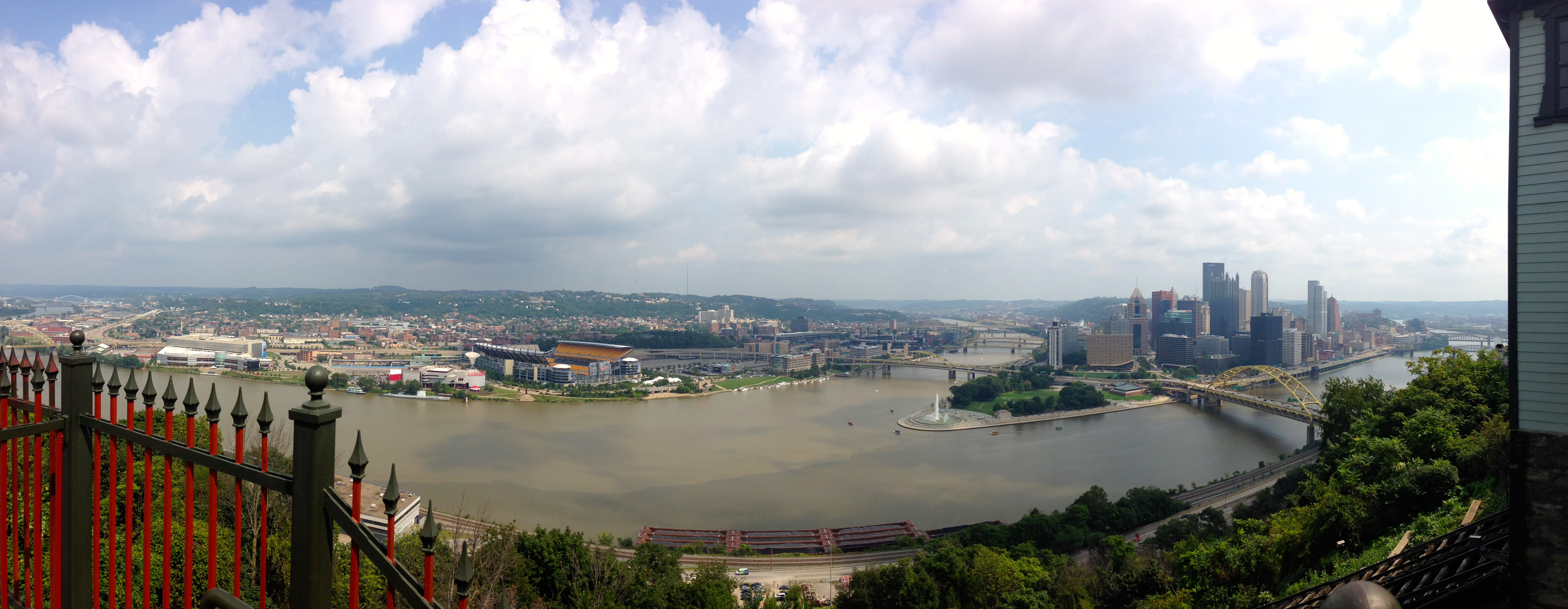
I started this blog in 2013 as a way to document a six-week road trip across the United States. By the time I got to Pittsburgh (three days into it) I was already tired of blogging. There was too much pressure every day to write and post pictures about my travels. So I stopped blogging and used Facebook instead, which worked out much better. More people got to follow the trip and it was easier to upload photos and descriptions.

And then I ignored this site for seven years. And to quote everyone’s favourite hobbit Sam Gamgee: “Well, I’m back.”

Lots of things have changed both in my own life and the world around us. Even as I write this, we’re in the middle of one of the most significant (and bizarre) events in history – a worldwide global lockdown due the COVID-19 pandemic. So let’s see how blogging in the ‘new normal’ goes. This time I intend to write more generally – articles about topics of personal and professional interest, like architecture, design, cities, art, and education. I may also throw in my thoughts about media I like – books, movies, television, and so on.

The first thing you’ll see over the next few days is a migration of a bunch of stuff I’ve written in the past year or so from Medium.com, a site that I now find to be slightly better than useless in terms of getting people to discover and read what I write. After that, I hope to write more frequently, formal as well as informal stuff. So watch this space. And if what I say sparks any thoughts, do me a favour and post your comment. I like to think of writing as dialogue – thoughts and ideas improve when they’re discussed, debated, and revised. If I wanted “likes” I would just keep writing on Facebook. So if you have a response to what I say – a comment, a question, a critique – then let me know right here where I can see it.

Oh, one more thing. Back when I started this in 2013, the blog was called “long division”. Don’t ask why. I’m not even sure I remember exactly. I changed the name to palimpsest, which is one of my favourite concepts in design and abstract thinking. Technically the world palimpsest refers to a phenomenon that occurred before the printing press was invented, when scribes used to write manuscripts on parchment paper. Since the parchment was expensive (usually made from animal hides), when they wanted to write new pages, they would scrape off the original writing as best as they could and write new text over it. Over multiple instances of this, one could see several faint layers of the old text beneath the new, forming a sort of abstract pattern of lines that no longer looked like written language.

Palimpsest - Wikipedia
The Codex Ephraemi Rescriptus, a Greek manuscript of the Bible from the 5th century, is a palimpsest. (Source: Public domain, wikipedia.com)

This idea of layers of information added continually on top of each other fascinates me. The word is now used abstractly to describe any kind of layering of elements where the previous layers can still be discerned. One sees this in cities and settlements, in architecture and habitation, in objects and images. If you look deeply at anything, there is a palimpsest there that enriches and illuminates the entire history of the thing being observed. The term also refers to the idea of repurposing and reusing something, which, aside from being a generally good way to approach an otherwise wasteful world, is a fitting reason to use it as the name of this site – a digital space that was initially meant to do something else entirely. That’s why I’ve decided to keep my old posts from the original blog. There’s only four of them, and nothing’s wrong with them. You might even like reading them.

Hopefully as this space fills with new thoughts, new ideas, and new information, it will add to and enrich the palimpsest of thoughts we encounter every day.

three post-industrial cities – 1/pittsburgh

(This is the first part of three successive entries about Pittsburgh, Cleveland, and Detroit – the first three cities I’ve visited on this trip. All three faced similar problems with post-industrial decay, and all three have responded differently and achieved different results.)

IMG_2335

Despite knowing that Pittsburgh is an Appalachian city, it never occurred to me that it was a city of hills. Or more accurately, it’s a city of hills and rivers and bridges. Approaching from the southeast along the Monongahela River, the city revealed itself dramatically; the approaching driver (myself ) crosses a series of tunnels bored through the Pennsylvania mountains. The tunnels give way to steel bridges and suddenly Pittsburgh appears from behind a hill and you see the skyline, but also the confluence of three rivers that give Pittsburgh its unique geographical qualities. Here, the Allegheny and Monongahela Rivers converge and become the Ohio River, which later merges with the Mississippi, many, many miles downstream. The convergence is geographically critical to Pittsburgh’s history and identity, first as an ideal place for an industrial city to grow, and later as a focal point for the city’s post-industrial transformation.

Despite being ignorant of Pittsburgh’s topography, I had known about Pittsburgh’s recent awakening from post-industrial slumber. I knew that Pittsburgh successfully pulled itself away from its decaying industrial past and shifted its economy toward tourism and technology, while also dedicating itself to improving the infrastructure of its waterfront. I knew that during the recent recession, Pittsburgh was one of the only cities to have its economy grow. And after visiting it, I think I better understand why Pittsburgh’s renaissance has been so successful where other post-industrial cities are still floundering. There were essentially three moves or qualities that I felt contributed to this.

IMG_2288 IMG_2291 IMG_2295

First, Pittsburgh wisely chose to focus on its waterfront as a physical manifestation of rebirth. New stadiums were built on the North Shore, taking advantage of striking views. My very first activity in the city was to watch a baseball game at PNC Park, which uses the downtown skyline as an outfield backdrop to great effect. The ballpark itself is similar to other new ballparks built in the Camden Yards era, with open concourses, intimate views, and richly textured details. The key to PNC Park is its location, both with respect to views from the seats themselves as well as its proximity to the downtown district and the new riverfront walkway. It was exciting to see that, after the Sunday afternoon game, many fans spilled out of the stadium and onto the walkway, strolling up and down like tourists. The walkway itself is extensive, open, and has active uses attached to it. Play fountains, boat hookups, food festivals – I saw all of these and more when I walked up and down the walkway. It’s a vibrant space, and has great connections to both sides of the river, its buildings, and its cultural institutions (museums, sports venues, entertainment, etc.)

IMG_2367

On the promontory known locally as “The Point,” a new park has been designed, with a massive water fountain marking the triangle where the two rivers converge and become the Ohio. The fact that this important geographic area and valuable real estate was set aside not for corporate use but for public space is great, even though I’m not a huge fan of using traditional fountains as markers for public gathering. In this case, however, it works. People sit all around it, and it’s visible from the entire waterfront.

The main downtown waterfront isn’t the only one that’s received redevelopment attention. The South Side Flats district, despite becoming somewhat gentrified, is also an area of cultural significance. Not quite as touristy as the downtown riverfront, the South Side is a nice active area of restaurants, bars, and new housing that has attracted many of the younger people who’ve chosen to move to Pittsburgh.

The second quality that Pittsburgh has chosen to exploit is its educational resources. I stayed in the university district, and it was clear that it is a thriving and active neighborhood. Pittsburgh has smartly made sure that its universities are encouraged to grow, attracting professional and academic development and research when other post-industrial cities have suffered a brain drain in recent decades.

IMG_2304

The third observed quality is Pittsburgh’s manageable size. It takes no more than 20 minutes to drive from one end of the city to the other. Its major districts are well connected despite being separated by three rivers. The city has over 400 bridges, none of which charge any sort of toll or fee, so there’s no obstacle to move quickly and easily between neighborhoods by car.  And all the diverse and varied neighborhoods of Pittsburgh are not too spread out or very large. Presumably this is aided by the city’s topography… there is literally no means to achieve horizontal sprawl with so many hills.

 Speaking of Pittsburgh’s neighborhoods, I found a similarity here to Baltimore, where I lived for five years in the early 1990s. Like Baltimore, Pittsburgh has a wealth of small, diverse neighborhoods that are close together and have fuzzy borders. It was often hard to tell which neighborhood I was in at the time, or where the borders between districts actually began or ended. Sometimes, I’d be driving through a visibly sketchy neighborhood only to find myself out of it in a manner of minutes. So, if there are areas that are less gentrified, less developed, and more poorly maintained, these areas are small. It’s reasonable to assume that their close proximity to other thriving neighborhoods will have a contagious effect inevitably. I could be wrong.

 I think these three factors have contributed strongly towards Pittsburgh’s unusual success. Capitalizing on the city’s geographical aesthetics, its educational and social resources, and its finely grained neighborhood-level diversity and compactness have made it a city well worth learning from, and it’s no wonder that Pittsburgh has become the poster child for post-industrial urban recovery and renewal.

day01: mile zero

IMG_2243

Aug 31 2013

The photo above is the view from Mile Zero. Sitting in the car, fingers tapping the steering wheel, partly in excitement, partly in trepidation. Everything is packed, whatever could be arranged is arranged, and now there are no more reasons to not lift the foot off the brake and put it gently on the accelerator and move away from the familiar into the non-quite-as familiar. So I go. It’s 10am on Saturday, and when I pull away from my parents’ suburban house on their suburban street, I turn on the radio and Car Talk is on. Tom and Ray Magliozzi’s Boston-accented automotive advice takes over my attention and now there’s no trepidation, only chuckling. At both their wacky car humor and the serendipity that has my road trip begin with broadcast automotive exuberance.

My first stop is Wayne, New Jersey, to pick up a box of audiobook CD’s that my friend Mike graciously dug out from his attic, a last-minute brainstorm that ensured that the long bleak miles on the road would not go by in boredom.

Carton full of audiobooks in hand, my next stop is a suburb of Allentown, PA where my high school friend Elysse lives. I stop to have lunch and we catch up on 25 years of jobs, marriages, kids, homes, and how much we’ve both changed since we were teenagers. Elysse’s story, inasmuch as it relates to geography, is interesting to me, particularly on this trip, because of the changing relationship between home and work. She’s lived and worked in urban areas, and also lived and worked in suburban areas, and now works from home. She relates a common American story: at first working and living in the city, then moving to the suburbs. As Vishaan Chakrabarti points out in his recent book, A Country of Cities, 68% of Americans now live in the suburbs, and more than 90% live in areas where residential density is less than 20 units per acre, below the threshold of being serviceable by mass transit. In addition, 46% of Americans now commute from suburb-to-suburb so that the arteries that once took suburban dwellers from their homes to the mall, or the doctor’s office – occasional trips, for the most part – are now clogged with rush-hour traffic not unlike that found in urban centers.

Elysse has started working from home, so that’s been a saving grace. She gets to spend more time with her family and less time on the road. With the massive increase in digital connectivity, working from home is being seen as the “savior of sustainability”. I think people assume that eventually, we will all be working from home and our roads will once again be clear and free of commuting traffic. It would be interesting to see how much of this turns out to be true. When I get a better idea of the statistical trends, I’ll discuss this more, but anecdotal experience certainly helps to put a face on what is otherwise numbers to me.

I didn’t think I’d start thinking about commuting and suburbs by lunchtime of the first day, but there it is… This where the trip is going to be of value. Combining the experiences of meeting friends old and new, learning about their lives, and somehow weaving their stories into the greater theme of urban design and planning.

I left Elysse around 2:30pm and drove about 4 hours toward Fallingwater, the home designed by Frank Lloyd Wright in Mill Run, PA. I had a 10am tour the next day, so the main order of business was to find a place to sleep. I purposely didn’t plan this out because I wanted to find a campsite or cheap motel close to Fallingwater. As I took the exit off of the Pennsylvania Turnpike, I stopped at a Dairy Queen for a Blizzard and asked the girl at the counter if there were any campgrounds nearby. She mentioned two, and I called them up, asking for rates. They both had sites available, at about $24-27 for the night. Not bad, I thought, but let me see if I can find anything closer. Fallingwater itself was still about 20 miles away.

I drove through rural roads, with strange mix of traditionalism and commercialism on the roadside. This area, the Laurel Highlands, are popular for tourists in the summer – camping, rafting, hiking, etc. There were dozens of places that offered some form of entertainment or another, interspersed with open farmland and fields. I pulled into one campground and immediately regretted it. It looked like a carnival was going on. There no sites available anyway, so I moved on. I almost passed by a sign – “Hideway Campground” and immediately liked the sound of it. Pulling in, it was easy to see that this was everything the other place wasn’t – quiet, wooded, small. There were available sites and they only cost $16. A great bargain, and fantastic value. So, the first night of my road trip would be spent under the stars.

IMG_2246 IMG_2244

To round out the evening with more happiness and good cheer, I made acquaintances with the family camping next door – A.W. and Karen from Pittsburgh, with their 11 year old daughter. I asked for A.W.’s help to lend me a light to start a fire, and after a while, we got it going. They offered me all kinds of snacks and beverages, and told me about themselves; how they were from Louisiana originally and had been living in Pittsburgh for 13 years. They had 6 other grown children, all over the country. They were Mormons, so they when they heard about my road trip (and planned stop in Salt Lake City), they told me to check out the Temple and Tabernacle there. Since I had nothing to share with them, I drew a little sketch of them at their campsite, which they appreciated immensely. It was good to share their kindness and goodwill, and it made for a great first day.

Connecting us to old friends or new, experiences easy and difficult, the road we think is so familiar, always yields up surprises.

flexible planning

I describe the way I generally muddle through life with the term “flexible planning”. I don’t know if it’s an original word or not, but it describes the vague middle ground that I’ve settled into with regards to how I organize my time. On the one hand, I like to plan things in advance. I don’t like entering into a situation without at least sizing it up and figuring out how to make the best of the time I have to do it.

On the other hand, I’m rather lazy. I can only take planning so far before I get bored and want to move on to something else. These two elements of myself are constantly at odds with each other; I wish I could be a better planner, but I’m too lazy to be good at it. I also wish I could be more spontaneous and not worry about how things will play out, but I’m too anal to just let things happen on their own.

I guess I’m an organized slacker.

Anyway, my slacker self wanted to approach the planning for this trip more loosely, and let the road and the landscape inform me where to go and what to see. But my rigid self wasn’t having any of that and soon took over, as rigid martinets are often prone to do. Soon, what started out as a loose chain of cities to visit became a full-blown itinerary. I stopped short of making it hourly and, as it stands, it’s precise  to the general time of day – morning, afternoon, etc.

So I have an idea of what I’ll be doing every day of this six-week trip, but I tried to incorporate as much looseness and flexibility as I could (or could be comfortable with). What follows is my current tentative itinerary. It doesn’t look like it’s very pliable right now, but don’t worry… I’m going to try to let my slacker self have his way with it as much as I can without having a complete id/ego/superego Lord of the Flies-level breakdown.

(Note: I’m linking to an existing Google spreadsheet. I sincerely hope this works and it’s halfway legible.)

have degree, will travel

Some explanation may be required.

If you’re reading this message, it’s probably because I asked you to. If I asked you to, then it’s probably because I know you well enough. If I know you well enough, it’s probably because you’re at least a little bit interested in what I’m doing and where I’m going. If you’re interested in what I’m doing and where I’m going, then you probably won’t mind a little bit of explanation about what this blog is all about. So let me tell you.

As most you of know, I’m a professional architect and non-professional urbanist. I teach for a living, but I also like to teach for free. I was born in India, grew up in the United States and began my career there, and then moved to India in 2009. I returned to the USA in 2012 in order to pursue a Master’s Degree in Architecture History and Theory. That’s what I’ve spent the last year doing and now that’s done. During this past year, I’ve been doing a bit of research in architecture and urbanism, specifically the relationship that Americans have with cities and suburbs. I won’t go into a long history lesson here, but the focus of my interest has been to discover why people choose to live in – or outside of – cities. As a professed city-lover who has also lived in the suburbs, I’ve been trying to reconcile my own personal faith in the dense urban life of the sort glamorized by Jane Jacobs in the 1960’s with the inarguable desire for people to live away from cities, in private enclaves, separated by lawns and driveways and swimming pools.

I’m not a fan of suburban sprawl. I feel the suburbs – with their parking lots, shopping centers, strip malls, and chain restaurants are monotonous, lifeless, and reflect the easy, least-common-denominator lifestyle of modern American society. But that’s my personal prejudice and I own up to it. Clearly not everyone feels this way, and I understand many of the reasons why they do. But I feel that deeper understanding is in order. I spent the last year reading books and writing papers about these issues, and dove into them like a true academic. But ask any of my former students and they’ll tell you that I encourage learning-by-doing, and I can’t absolve myself of the same responsibility to better understand that which I disagree with by experiencing it in person.

So, I decided to travel the USA. Starting on August 31, 2013, I will be traveling the American landscape and roadscape for six weeks, visiting friends and relatives, but more importantly (for my research, anyway), visiting cities and suburbs and vast stretches of empty land and trying to better understand why people choose to live the way they do, in the places where they do. I’ll be documenting my observations and revelations in this blog, sharing what I see and experience with anyone who’s interested. I’ll be driving the whole way, stopping at places both planned and unplanned, following an itinerary both fixed and flexible.

I’m not entirely sure what I’ll find; the trip may reaffirm or contradict the things I already know in the academic sense. I’ve taken many road trips in my life already, so traveling by car over long distances is no new thing. But this is the first time I’m doing it with some “academic” purpose in mind. Some of what I find will supplement the things I learned from previous road trips; some things will contradict them.

I should also warn you (and this may be redundant for many of you), that once I get started in explaining things, I have a hard time stopping. This first post is a great example; it probably should have ended five paragraphs ago. I apologize in advance if, at best, this blog bores you or, at worst, it becomes a flood of narcissistic navel-gazing ramblings from the mind of a pedant. If any of that happens, well… you can do what most democracies in the world still allow you to do: change the channel. If you stick around, though, I hope you’ll comment and share your opinions and, by all means, express your discontent and disagreement. I won’t mind at all.

I think that’s enough explaining for now. There’s plenty more to come.